Safety awareness
Reveal recurring conflict points, unsafe movement and operational blind spots.

LidarTwin transforms movement across people, vehicles and environments into operational intelligence—helping organisations improve safety, optimise operations and make better decisions through spatial intelligence.
LiDAR uses rapid light pulses to create a precise three-dimensional model of an environment. It measures distance, shape and position, allowing people, vehicles and objects to be understood as physical geometry—not only as imagery.
As that 3D model updates, movement becomes measurable: trajectories, speed, dwell, queues, occupancy and changing patterns. Because LiDAR supplies its own light, it can support consistent spatial perception by day or night.
For LidarTwin, this means the physical world can become a reliable source of operational intelligence—helping organisations respond earlier, use space more effectively and make decisions based on what is actually happening.
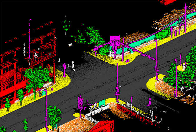
Queues build gradually. Conflict points repeat. Zones become crowded. Space goes unused. Spatial intelligence turns these movements into a measurable operational picture.
Live trajectories, approach speeds and lane conditions help infrastructure respond to the environment in real time.
Live queue length, wait time and flow signals help operations teams respond earlier.
Begin with the decisions your teams already need to make—not with a predetermined sensor or platform.
Reveal recurring conflict points, unsafe movement and operational blind spots.
Measure journeys, waiting times, bottlenecks and changing demand.
Understand how entrances, zones and shared environments are actually used.
Support staffing, layout, capacity and infrastructure decisions with objective data.
Representative environments where LiDAR-led spatial intelligence can improve flow, utilisation, awareness and decision-making.
Visitor journeys, dwell, occupancy and crowd-flow intelligence.
Entrances, walkways, shared spaces and utilisation patterns across the site.
Waiting, corridor, occupancy and service-pressure visibility across hospital environments.
Yard movement, restricted zones and vehicle-person interaction awareness.
Whether you have an early operational question, a defined project, a deployment-ready requirement or a technology partnership, the first step is a focused conversation.